
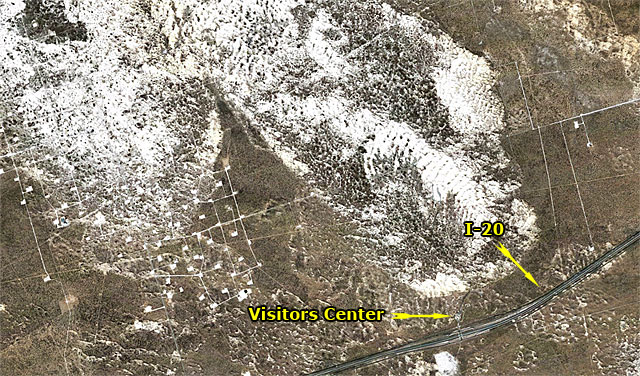
Astoundingly intelligent Gazette readers Gregg Ulvestad, Chuck Rubins, and Paula McKinney correctly identified aerial photo numero cuatro as the world-famous Monahans Sand Hills State Park.
I have fond memories of the Sand Hills, despite taking two classes of fifth grade boys over for the day as a part of my Sunday School teaching duties. (Word to the wise: windy days and hot dogs don’t mix well in that part of the country. I’m still brushing sand out of my teeth, even though that was 20 years ago.) Not only did I learn to sand surf there, but I recall a great zoological moment when, following a particularly wet spring, someone dug up a 9-inch long salamander who had emerged from a lingering water hole. How long had that critter been dormant beneath the sands, waiting for a wet wake-up call? But I digress. For those who didn’t recognize the shot, here’s something to help you get your bearings. (By the way, Chuck and I would like to know the identity of the oil field offsetting the park to the west.)
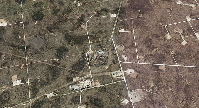
OK, I’ve been pretty easy on you up to this point, but this is where the gloves come off. I shall bow before your cartographical awesomeness if you can identify the following scene.
By the way, we’re taking the weekend off here at the Gazette, because we’ve been working so gosh darned hard bringing you all this bloggy goodness. So the answer will be posted on Monday.
Click on the picture to see a larger version.
Viewed from 10,000′
Discover more from The Fire Ant Gazette
Subscribe to get the latest posts sent to your email.
Eric, to answer the question on the name of the oilfield to the west, oddly enough its named the Monahans Field (http://www.satelliteviews.net/cgi-bin/g.cgi?fid=1341797&state=TX&ftype=oilfield)
Now the current pic appears to be the Odessa Meteor Crater.
Hope you guys have a great weekend in the hill country!