
Two months ago, I couldn’t spell “cartographer,” and now I am [on my way to becoming] one. As a Geographic Information Systems (GIS) specialist, my duties include generating and editing maps, and I’ve found the learning curve to be challenging.
There are actually two different challenges. One involves learning the systems we use for mapping. Most of our engineering and geological analysis tools (for those in the know, we use Petra and GeoGraphix) include mapping modules, as do many of our online sources of production and industry activity data. Our company has a proprietary mapping application, and I’m also learning to use ArcGIS, one of the most powerful standalone GIS programs in existence. So, thus far I’ve used about six different programs, none of which I’d ever seen before August 22nd. Fortunately, they all employ similar conventions and processes, so the transition from one to another isn’t that tricky. But like so many things in life, they’re easy to learn and difficult to master.
Not one of mine.
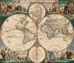
The more interesting challenge is understanding the basic cartographic theories. I’ve always been fascinated by maps, but I never grasped the complexities involved with creating even the most basic maps, beginning with the fundamental issue of how one translates the features located on a sphere (the Earth – more correctly defined as a spheroid) onto a flat surface (a map displayed on paper or a computer screen).
The process of converting a three dimensional representation of the earth onto a two dimensional surface is called “projection,” and humans have been experimenting with different kinds of projections for more than 2,000 years, trying to come up with the “best” way of locating geographical points of interest. The thing that all projections have in common is that they don’t tell the truth…that is, none of them are completely accurate 3D-to-2D translations. They all distort one or more of the following characteristics: direction, distance, shape, or area. (For a nifty comparison of the more common map projections and their uses, advantages, and drawbacks, refer to this USGS resource.)
This is not just an academic or theoretical issue. The accuracy of maps has real and often significant implications. Maps can also be manipulated to achieve specific goals or serve specific agendas.
I’m reading a book entitled How to Lie With Maps by Mark Monmonier. I recommend it both as an easy-to-read reference for basic cartography, and as a primer on how maps are used to exert social, cultural, and/or political influence in ways that aren’t necessarily ethical.
Anyway, while my specific job duties don’t necessarily require that I understand some of the more esoteric cartographic principles, my natural curiosity about such things has led me to delve into a wide variety of resources, and if nothing else, I’ve learned how much I don’t know. I’ve delved into the world of Great Circles, rhumb lines, sinusoidal projections, graticules, and azimuths.
That seems to be the story of my life. I keep telling myself that that’s a good thing; it will keep my brain young. Someday, perhaps I’ll even convince myself of that.
Discover more from The Fire Ant Gazette
Subscribe to get the latest posts sent to your email.
OK, so I thought I should show you the best “map books” that I’ve read:
“The Measure of All Things,” … http://www.amazon.com/Measure-All-Things-Seven-Year-Transformed/dp/0743216768/ref=sr_1_1?ie=UTF8&qid=1318901954&sr=8-1
And:
“Measuring America,” … http://www.amazon.com/Measuring-America-Wilderness-Fulfilled-Democracy/dp/B0009YAR7S/ref=sr_1_2?ie=UTF8&qid=1318901706&sr=8-2
And I heard of a new one, titled “Maphead,” by Ken Jennings (the big Jeopardy winner guy)
Thanks, Berry…I’ll check ’em out.