
Note: The overly precise and unimaginative post title is for maximum search engine-friendliness. This is more or less a public service article.
Another Note: This was posted in 2012. I haven’t lived in Midland since 2017. For all I know, the earth has split open somewhere along the route described below, providing a direct access to Hell. So, cycle carefully.
Several people have recently asked us where we ride our bicycle in Midland. They’re either new to the city, or new to our neighborhood, and they haven’t found a route that has the right mixture of safety, scenery, and mileage.
Debbie and I have found a route – with several variations – that provides that mix for us. It may not work for everyone, and it works best for those who live outside of Loop 250, but we’ve received enough questions about it that it seems worthwhile to create a post that will provide someone doing a web search for phrases like “Midland Texas bike route” or “bicycle route in Midland” with more details.
Below is a Google Earth screenshot; the route is shown in yellow. I’ve assumed a starting point at the intersection of north “A” Street and Mockingbird Lane. As shown, it’s about 12 miles in length, and runs to Highway 158, on the western edge of the city.
The route crosses a couple of busy streets, but not at busy intersections, if that makes sense. The busiest intersection (Briarwood and Holiday Hill) has a traffic signal and is relatively bike-friendly. Otherwise, the entire route consists of neighborhood streets and even bypasses all school zones and the associated congestion that occurs around them during certain times of the day.
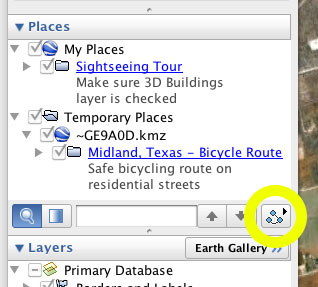
If you want a more interactive and detailed version of the route, I’ve created a KMZ file that can be opened with either Google Earth or Google Map. If you use the latter program, you can click the “Play Tour” button and “fly” through the entire route. To use the Tour feature, click on the route title in the Google Earth sidebar to select it, then click the inscrutable icon beneath that title (see screenshot at right; said inscrutable icon is circled in yellow).
Opening the route file in Google Maps or Google Earth is easy. Download this file to your hard drive, then start up your preferred application and click the “Open” option under the “File” menu item at the top of the window. (In Google Maps, you have the additional option to import the file using its URL: http://www.ericsiegmund.com/fireant/MidlandTexasBikeRoute.kmz.) The route will be overlaid onto the map and the program will automatically zoom in or out to show the entire route. You can then zoom further for more details.
I’ve also inserted a few waypoints with notes about the route. There are some new sections of streets that provide cyclists with the ability to avoid some busier routes, and I’ve also noted some route options that you can use to increase your mileage or vary the scenery.
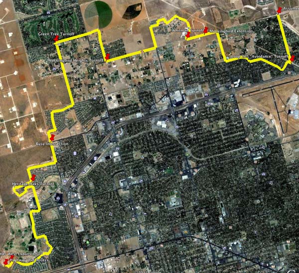
If you’re new to Midland, I recommend riding through the Green Tree development, entering either from the west via Holiday Hill Road, or from the south via Oriole Drive. This will add a couple of miles of low-traffic riding to the route, if you ride the north and south loops of the development.
Incidentally, it’s probably already obvious to you, but if you want hill training, you should consider relocating. Over this twelve-mile route, the elevation change is less than 70′. There’s one point along the route where the grade is almost 3% (gasp!), but that’s the closest you’ll get to a climb. On the other hand, the West Texas winds more than make up for the lack of hills.
I noticed something interesting while reviewing the flyover. In more than 12 miles of riding through city streets, I counted fewer than 35 cars on the route. The date on the satellite photo was June 16, 2011, which was a Thursday, so there was no apparent reason for an absence of traffic. Regardless of the reason, it makes for happy cycling!
Discover more from The Fire Ant Gazette
Subscribe to get the latest posts sent to your email.
The crop circles over toward Green Tree, is that a sewage treatment plant?
No, those are actual crop circles. That land just east of Green Tree is under cultivation, periodically at least.
The water treatment facility is at the intersection of Bluebird Lane and Midland Drive, a couple of miles to the south.
Please send this route. Can’t open it. Thanks
Jessica, you should be able to download the kmz file using the link in the post, and then import it into Google Earth. It works for me.