
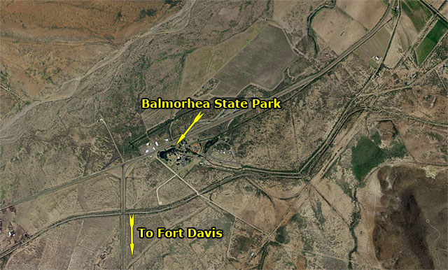
 Gazette-crazy map mavens Paula McKinney and Les Blalock recognized the sixth photo in our series as Balmorhea State Park, which has the distinction of not actually being located in Balmorhea, but “Toyahvale State Park” apparently doesn’t have the same cachet.
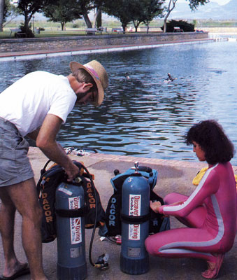
Every scuba diver in West Texas has cruised the crystal waters of Balmorhea. Debbie and I did our check-out dive there when we got certified, and have returned repeatedly to give our the gear the once-over before dive trips. One memorable trip had us surfacing to find a light snow falling; the spring-fed pool is a constant 72°-76°, and it was 40° warmer than the air temperature that day.
Another interesting bit of trivia (well, interesting for us, anyway). If you happen to have a copy of the August, 1988, issue of Texas Highways laying around, check out pages 30-31. They feature a particularly handsome couple intent on checking out their scuba gear. You’re forgiven if you didn’t recognize us in the photo above; Debbie was rocking her Flashdance look, and I had lost my razor a few years earlier.
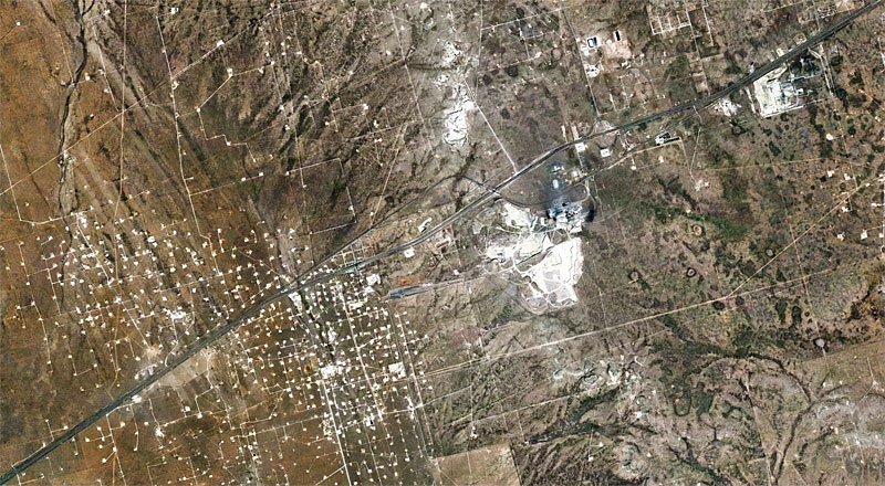
We’re coming to the end of the series, and I must say that I’ve been impressed by your ability to ferret out the identity of famous features of West Texas. This next one is obscure enough that if you figure it out as easily as the previous photos, I’ll have to consider the possibility that you’ve installed keylogger software on my computer. Have at it…
Click on the picture to see a larger version.
Viewed from 10 miles
Discover more from The Fire Ant Gazette
Subscribe to get the latest posts sent to your email.
That white area south of the highway (IH20) is the cement plant west of Odessa. I believe this would be about where the railroad camp of Caprock was located when the railroad was being built. There’s still a few remains of a stone building right along there somewhere.